Mapping village in Messaure hydropower plant dam
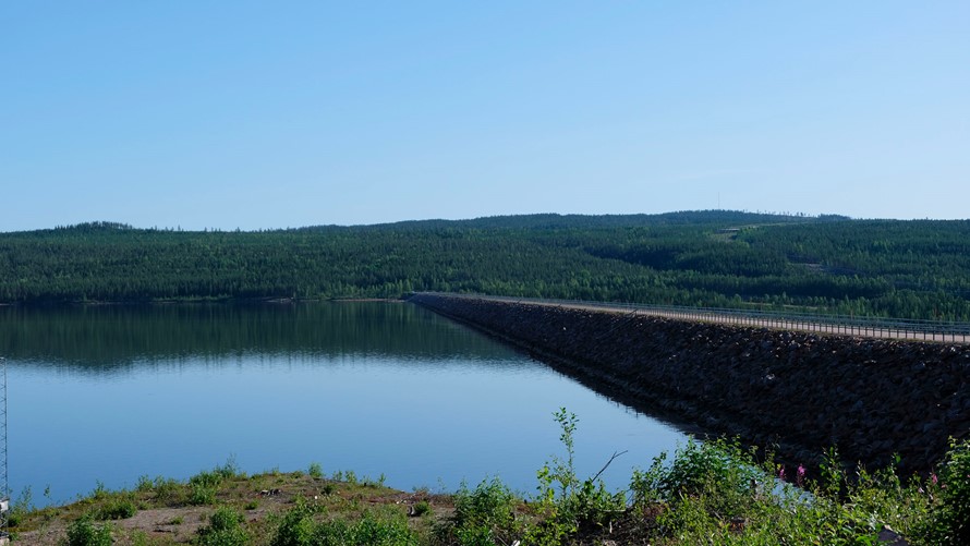
The Messaure hydroelectric power station, three miles north of Jokkmokk, is Sweden's third highest dam and was opened in 1963. When the power station was built, the residents of the village of Njuoravuolle were forcibly evicted and the construction also affected other people working in the area, including reindeer herding Sami. The village and nature ended up at the bottom of the dam. Now the village, which has been under water for more than sixty years, is being documented in a project that maps the impact of hydropower development in northern Sweden in the 1950s and 60s.
The village of Njuoravuolle was located on the Lule River and consisted of two villages from 1868. In total, some fifty buildings were affected when the land was flooded. The area that was flooded as a result of Messaure was also a common winter grazing area for the Sirges, Jåhkågasska, Tourpon and Udtja Sami villages. In addition, a currently unknown number of ancient remains were placed under water. Prior to construction, the Swedish National Heritage Board inventoried the area. Three Stone Age settlements were found with associated trapping pits for hunting moose and wild reindeer. Most of these ended up under water.
Now researchers at Luleå University of Technology, together with archaeologists from the Norrbotten's Museum and divers from Nordic Maritime Group, are mapping the village of Njuoravuolle located at the bottom of the power plant dam. The area has been investigated with side-scan sonar, underwater camera and by diving.
Source: Luleå University of Technology https://www.ltu.se/ > Latest news > News > Mapping village in hydro power plant dam ( published 30.9.2025)